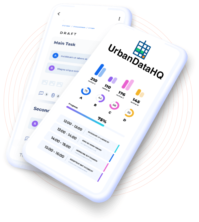
UrbanDataHQ is a modern, scalable, data-driven platform designed to empower developers, businesses, and governments with fast access to hyperlocal datasets. The platform aggregates, normalizes, and serves public and commercial urban data through rich APIs and intuitive dashboards.
The UrbanDataHQ logo was thoughtfully designed to reflect our mission: bringing clarity and insight to the complexities of urban life through data. The geometric grid symbolizes the structure of a city—its streets, blocks, and infrastructure—while also evoking rows and columns of a dataset. The subtle use of color conveys our civic-minded and tech-forward approach: blue for trust and professionalism, green for growth and urban spaces, and orange for vibrant, actionable insights. Together, this logo represents a modern, trustworthy platform built to serve communities with transparent, accessible urban data.
How It Works
Review 4.8/5.0
We’re launching UrbanDataHQ in a select group of cities chosen for their vibrant urban ecosystems, diversity, and demand for accessible civic data. This initial rollout sets the stage for scaling our platform nationwide.
Atlanta, Savannah, Charleston, Charlotte, Nashville, Austin, Portland, Seattle, Denver, San Diego — selected for their dynamic growth, rich datasets, and community engagement.
We’re starting with essential datasets in these cities, including transit stops, parks and amenities, building permits, neighborhood boundaries, and bike/pedestrian infrastructure.
Actionable analytics designed for developers, planners, and civic innovators — all powered by hyperlocal, trustworthy data.
Rich RESTful APIs serving urban datasets including transit stops, parks, permits, neighborhoods, and more.
Query by location, bounding box, or radius with full PostGIS-powered geospatial capabilities.
Manage API keys, monitor usage, and explore datasets via an intuitive online portal.
Receive real-time data feeds where supported, including transit updates and permit issuances.
Built-in analytics tools to visualize and explore trends in urban data.
Built on modern cloud infrastructure ensuring reliable performance and security at scale.
UrbanDataHQ is built with flexibility in mind. We’re planning integrations with leading GIS platforms, business intelligence tools, and civic tech systems to ensure your workflows remain seamless and efficient.
Planned integration with ArcGIS and other GIS software to bring spatial data directly into your maps and analysis tools.
Future support for Tableau, Power BI, and other BI platforms to help organizations visualize and analyze hyperlocal data.
Essential access for individual developers and hobbyists
API access to selected datasets
Up to 1,000 API requests/month
Standard documentation
Community support
Designed for small teams needing reliable urban data APIs
API access to core datasets
Up to 10,000 API requests/month
Email support
Usage analytics dashboard
Priority dataset updates
Advanced features and scale for businesses and civic organizations
API access to all datasets
Up to 100,000 API requests/month
Priority email & phone support
SLA-backed reliability
Early access to new datasets
UrbanDataHQ empowers developers, civic leaders, and businesses with fast, reliable access to hyperlocal urban data.
Subscribe to UrbanDataHQ Weekly — your source for platform progress, new hyperlocal datasets, and updates on how UrbanDataHQ empowers smarter cities.